Help: Maps
REAL-COMP InfoSearch™
provides several different mapping options.
Remember: Not every county supports each map type.
Instructions:
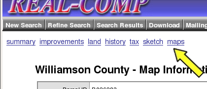
When viewing the details for a parcel, choose the maps
link to view map information. The maps link is
indicated by the yellow arrow in the image below.
The following maps are provided:
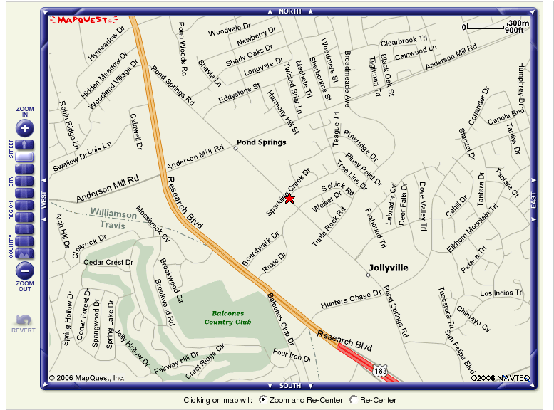
MapQuest Street Map
CAD Tax Map
MapQuest™ Street Map
The MapQuest™ street map is available for all counties.
Click the  image to open the
street map for the current parcel. The map will open in a new
browser window. image to open the
street map for the current parcel. The map will open in a new
browser window.
A sample MapQuest map:
[top]
CAD Tax Map
The County Appraisal District (CAD) Tax Map is available in
several counties, and we are expanding this feature as data
becomes available. The Tax Map shows lot dimensions and other
valuable information.
To view the tax map, click the download link on the
map page. You may be prompted to save or open the image. If
you choose to save the image, choose a destination for the file
that you will remember, so you can view the map up at a later date.
If you choose to view the image, your default TIFF image viewer
application will open and display the map. The map image is
very large and may take some time to open.
The map image is in the TIFF file format, which may require
additional software to use effectively. The IrfanView program
allows you to easily zoom and print these maps. A helpful
guide on how to install and use IrfanView is provided
here.
[top]
|
 Public and Permitted Use Information From Your Personal Computer